Podcast: Play in new window | Download
Subscribe: Apple Podcasts | RSS
 About 50 miles directly north of Guadalajara in the far southwestern corner of the state of Zacatecas, tourists, who are few, enter an interesting archaeological park in a beautiful, wooded mountain setting. No guide is needed because the ancient ruins of El Teúl has an app, albeit only for Android. For persons with disabilities not able to climb through the limited areas of the ruins recently opened to the public, they can sit comfortably on a bench and use a 3-D headset to experience the lost city virtually. Such advanced technology seems strange to see in this remote and nearly unknown place, especially since it is not found at some of the larger and more famous sites. It is here, though, available to the few members of the public curious enough to venture to El Teúl. Although relatively unknown, this city played an important role in the history of ancient Mexico for the better part of 2,000 years.
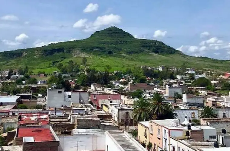
The archaeological site of El Teúl is often referred to as Cerro del Teúl so it is not confused with the town of El Teúl de Gonzaléz Ortega, the pueblo mágico, or officially designated “magical town,” which it overlooks. The name “Teúl” comes from an extinct Chichimeca language and was once a longer word, teulinchan, which means, “place of the gods.” A semi-sedentary Chichimec group called the Caxcan people occupied the site in the later centuries but were not the original builders. For more about these people, see Mexico Unexplained episode number 142 titled, “Chichimeca: Warriors of the North” https://youtu.be/p2e0fIy7Wg4 . The Caxcans were latecomers to El Teúl, only arriving there at around 1350 to 1400 AD, which was about the same time that the Aztecs were establishing themselves in central Mexico. Many archaeologists believe that the Caxcans took over the city from a group that was weaker either politically or physically and decided to dismantle some of the older buildings to refashion the site into a Caxcan ceremonial center. Some researchers push the Caxcan occupation back a few centuries, but no one really knows who lived in the city before the Caxcanes arrived. Archaeologists know that El Teúl had been continuously occupied from about 200 BC to the time the Spanish arrived in the early 1530s, thus making it one of the longest occupied cities in all ancient Mexico. It seems like the site’s heyday was sometime between 600 and 1100 AD, although there seems to have been ebbs and flows in the city’s population and regional status. Some archaeologists assign El Teúl to the ill-defined Chalchihuites culture for a few centuries of its existence, but that is not accepted as definite by many. So, for most of the time El Teúl thrived, it was occupied by a people or different peoples, who remain lost to history.
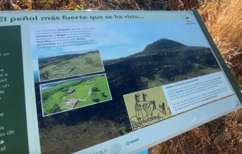
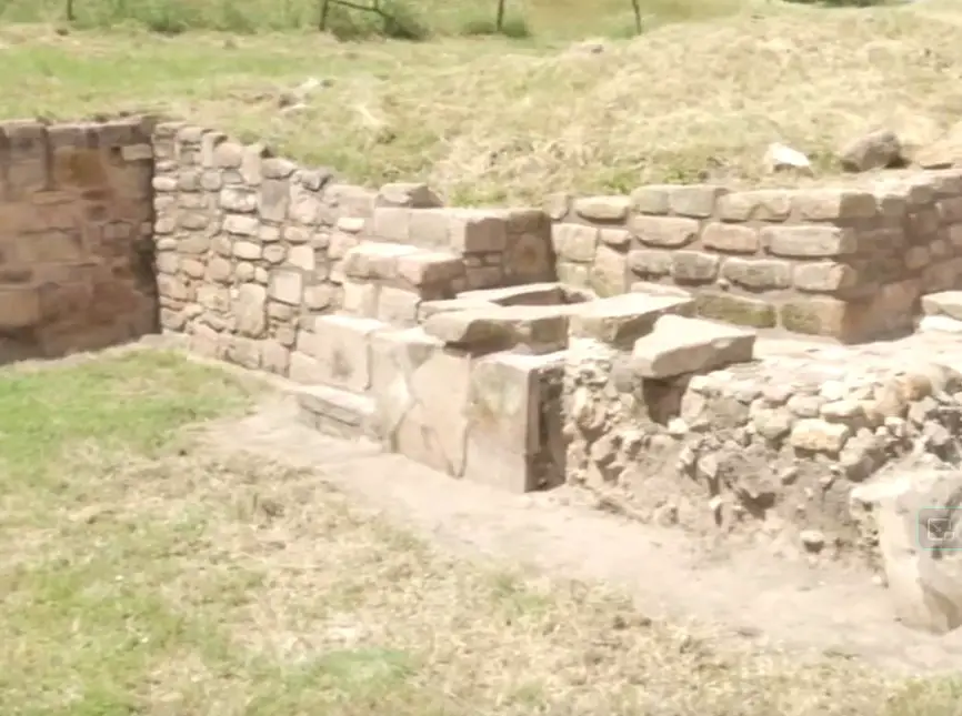
 Researchers estimate that the site of El Teúl covers well over 150 hectares. Only 6 hectares have been excavated and studied by archaeologists. The site was only opened to the public in October of 2018 and that was after 10 years of painstaking restoration and careful preparation by Mexico’s National Institute of Anthropology and History, or INAH. It was the third archaeological site in Zacatecas opened to the public and the 191st site in the whole country. From Ticuata Lake the hill on which the ruins sit, called Cerro del Teúl, looks like a gigantic sombrero. A Christian cross is found at the very top of the hill with most of the ruins found on the hill’s slopes. The summit of Cerro del Teúl affords sweeping panoramic views of the Tlaltenango Valley below. A road from the town of Teúl de Gonzaléz Ortega leads to a parking lot at the base of the hill and admission to the archaeological zone is free. From the parking lot it is a hike up to the main plaza of the ancient city with five rest stops along the way. One of these rest stops is a large shelter cave with seats carved into the rock by the ancients themselves. This part of the state of Zacatecas is quite lush and rainfall is higher there than the rest of the state, so visitors to the site enjoy the green subtropical scenery. On the way up the hill, climbers will also note the irrigation and water transportation system evident throughout the Cerro del Teúl. Small canals lined with rocks and masonry catch and carry water dripping off the various faces of the hill. This open-air plumbing system provided fresh drinking water and water for crops.
The endpoint of the primary trail is the main plaza of El Teúl. Flanking this public open space are two small pyramids, now called the Pyramid of the Sun and the Pyramid of the Moon. As there was no writing system at El Teúl, we do not know the proper names for these structures. These pyramids are more like platforms as they only rose to a little over one story tall when completely intact during the height of the city’s power. Small crumbling buildings are found around the plaza and were most likely residences of the city’s hereditary elite or for religious figures as was typical in most ancient Mexican cities.
 Underneath the main plaza archaeologists have found burials of high-ranking individuals dating to about 1,400 years ago. The skeletons had slightly elongated skulls and teeth that were filed into sharp points. Along with these skeletons, researchers found typical elite objects such as jewelry with shell or jade beads, and fragments of imported pottery. The burials found under the plaza were much different from the original burials at El Teúl which belong to what archaeologists call the “Western Mexico Shaft Tomb Tradition” and date to the early centuries BC. What is a shaft tomb? Picture a water well dug into the ground ranging from 8 to 60 feet deep and at the bottom of the well one or more chambers about the size of bedrooms in a modern house. Inside the chambers are the burials of individuals of higher social status accompanied by funerary offerings and luxury goods. Shaft tombs are usually found under or alongside important buildings. In Mexico, shaft tombs were used primarily in the western part of the country in ancient times, and they are found in the modern Mexican states of Nayarit, Jalisco and Colima. There are very few of these unique burials found in the state of Zacatecas. The “Shaft Tomb Tradition” crosses cultural and geographical boundaries and generally dates from about 300 BC to about 300 AD. Academics are still struggling to piece this tradition into the Mesoamerican tapestry and are baffled as to where this practice came from and what cultures used it and why. For more information about these tombs, please see Mexico Unexplained episode number 250: https://mexicounexplained.com/the-mysterious-shaft-tombs-of-western-mexico/
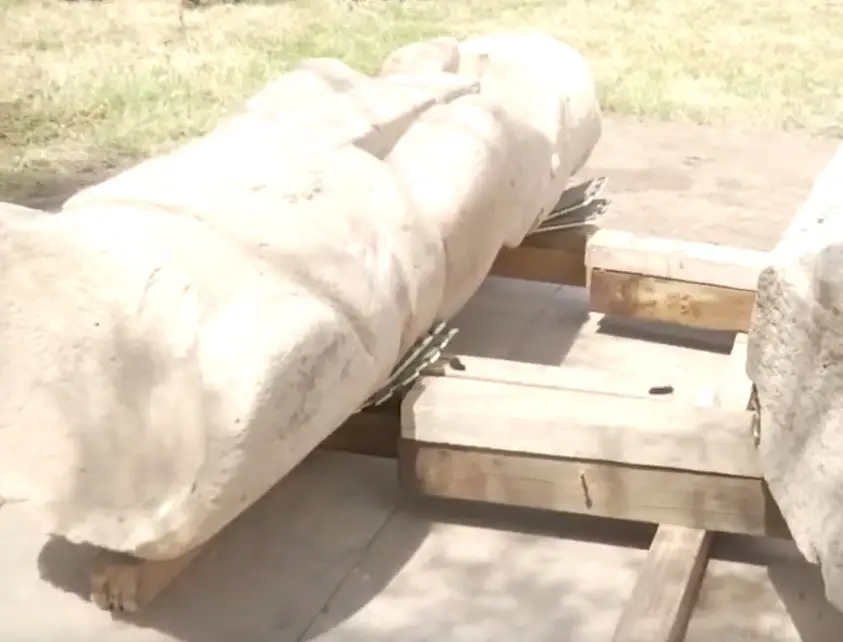
Near the central plaza is the great ballcourt of El Teúl. This ballcourt had two phases of construction. Researchers believe that work began on this court around 600 AD. Its remodeling began sometime around 900 AD when fine masonry was applied to the walls and additional walls were added to close off the court. One of the most important finds at this site associated with the ballcourt was the discovery of a life-size stone sculpture of a ballgame player who was decapitated. This is not merely a case of a sculpture with its head broken off; the decapitation was intentional and was part of the original artistic rendition to depict a sacrificial victim of these games. This sculpture weighs about a ton and may have companion pieces elsewhere at El Teúl that have not yet been found. During the excavations in the early 2010s, archaeologists unearthed a fragment of what may have been another ballgame player sculpture, but as digging at the site continues, there may be other surprises that await researchers.
 One of the most magnificent finds at El Teúl was an intact copper smelting furnace that dates to about 1000 AD. Metalworking began in west-central Mexico sometime around 900 AD and many people believe that the practice was introduced to the area from South America via the Tarascan people. So far, nowhere else is a complete furnace known to exist like the one found at El Teúl. The discovery of this furnace, along with associated workshops, has caused some researchers to call El Teúl, “The earliest industrial zone in the Americas.” The famous furnace was made of stone and masonry and was fueled by the burning of corn cobs and corn husks. Although current research is lacking, it is most likely that objects produced at the El Teúl smelters were exported throughout ancient Mexico. Archaeologists have found many traded goods in the archaeological record at the site, including ceramics from Teotihuacan, figurines from the Zapotec area and shell ornaments from the Pacific coast. Before metalworking became popular at El Teúl, researchers believe that the city was known as a pottery manufacturing site. The inhabitants of the site either substituted the pottery making for copper smithing or perhaps engaged in these two modes of production simultaneously. El Teúl is such a newly excavated site that there is a lot of work to be done to try to understand what exactly went on here and what groups of people occupied the site during its long history.
 When the semi-nomadic Chichimec Caxcan group took over the site, it is unclear whether they conquered the people who lived there already, or they moved into a ghost town. The Caxcanes must have prized the Cerro del Teúl for its defensiveness and some theorize that they may have occupied it to launch attacks on neighboring tribes. The Spanish conquistador Nuño de Guzmán even mentioned the hill in his diaries, noting that some of his group should take over the hill to better control the surrounding countryside. Under the command of Captain Juan Delgado, the Spanish eventually did, and the famous hill along with the Valley of Tlaltenango were completely subdued by 1536. Soon after, the Spaniards founded a small town near the base of Cerro del Teúl, the pueblo mágico mentioned earlier, which was originally christened San Juan Bautista de Teúl. With more interest in this area of Zacatecas and in El Teúl specifically, perhaps with time we will know the full story of this enigmatic and enchanting place.
REFERENCES
INAH Website
