
Podcast: Play in new window | Download
Subscribe: Apple Podcasts | RSS
 In the year 2014 Spanish travel YouTuber Paco Nadal landed on the remote western Pacific island of Kapingamarangi. This place is the southernmost island of Micronesia and is located 360 miles northeast of the island of New Ireland which is part of the country of Papua New Guinea. When Nadal landed on the island, he remarked how remote this beautiful place was and bragged that he was the first Spaniard ever to arrive at Kapingamarangi. While the first part of his statement is a matter of opinion, the proclamation that he was the first Spaniard to visit the island is untrue. In fact, the first Spaniard who arrived there in the year 1537 was a man named Fernando de Grijalva, a conquistador who had accompanied Hernán Cortés on his march to Tenochtitlán. It seems that Paco Nadal was 477 years too late and was proceeded by someone who was more than just internet famous.
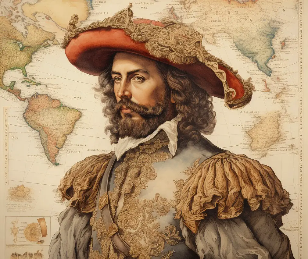
In the early 1530s, Cortés put Grijalva in charge of two small expeditions to explore the Pacific coast of what is now Mexico. Grijalva who was born in Cuellar, Spain sometime in the late 1480s, had known Cortés in Cuba and was eager to continue exploring and making conquests in the New World. Grijalva made it as far north as the Baja Peninsula and the Sea of Cortés. Cortés had grander designs for exploration, though, and wanted Grijalva to head a possible fleet to sail across the Pacific to the vicinity of the Moluccas or the Spice Islands, which were under Portuguese control at the time. The objective was to find unknown islands nearby and claim them for the Spanish Crown in order to compete against the Portuguese in the spice trade. In April of 1536 Grijalva returned to Acapulco from his last coastal expedition and at that time Cortés was arranging to send his trusted friend and compatriot across the Pacific as planned. Something then happened to upset their plans: Another famous Spanish conquistador, Francisco Pizarro, conqueror of the Inca, was under siege in Lima, fighting the forces of a cunning Inca military leader named Quizu Yupanqui. So, Cortés decided to send Grijalva to Peru along with a 26-year-old officer named Fernando de Alvarado who was from a prominent Spanish noble family. They took two ships – the Santiago and the Trinidad – carrying provisions, 60 Spanish and indigenous soldiers, horses, artillery and weapons, along with gifts for Pizarro and his wife. Grijalva commanded the ship Santiago and was under secret orders from Cortés to continue on to explore the “Great South Sea” after his relief mission to Peru was over. Grijalva told the crew of his orders while they were already well off the coast of South America and out to sea. It was a great surprise to the crew of the Santiago that they would not be returning to Mexico. Grijalva’s men were eager to point out that they were not well provisioned enough to make it to the Moluccas. The captain assured them that all would be well, and they would be able to acquire necessary supplies along the way. Thus began the expedition that would discover new islands that some claim may belong to Mexico to this day.
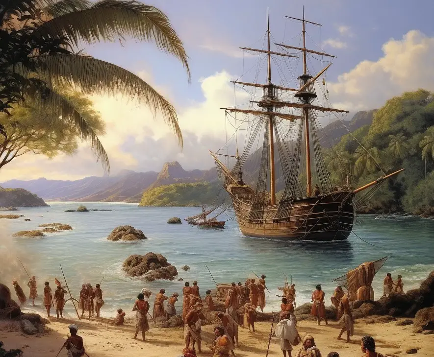
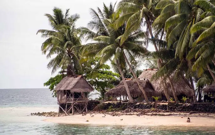
 After a few weeks, sailing was rough and the Santiago had not found the provisions along the way as they had anticipated. Grijalva skirted the Equator in hopes that they could catch seasonal downpours so the crew could have fresh water. At one point, near where the International Date Line is today, Grijalva decided to return to Mexico, but the winds were not in his favor. This caused even more anger among the weakened and sickly crew, but Grijalva insisted on sailing west. They were about 1,700 miles from the Spice Islands and over 7,000 miles from Mexico when they came upon an atoll they named Matador. This atoll and outcroppings of reefs is also called Acea. It’s located 163° 12’ east longitude and just a little over 1° north of the Equator. A crewmember later would describe Matador as consisting of 15 small islets with many reefs. It had thick coconut forests and was inhabited by what was described as “light copper-colored natives” who had wavy red and black hair. The next island Grijalva and his men came upon was the same one Paco Nadal visited as mentioned in the beginning of this episode: the atoll comprising 33 small islets now called Kapingamarangi. Grijalva named this atoll Isla de los Pescadores, or Island of the Fishermen, and christened the main island Isla Nueva, or New Island. Full of fresh coconuts and water, this place has served as a refreshing stopping point since Grijalva’s times. Continuing west toward the Spice Islands, the Grijalva expedition discovered two more islands: Corona and Los Guedes. Corona was a small round-shaped island with no other description. Los Guedes, a group of 5 small low-lying islets, is located 120 miles north of New Guinea and is presently claimed by Indonesia. The island is now called Mapia. In Grijalva’s time, the heavily forested atoll was inhabited by a Melanesian people called the Onaca. On later Spanish maps Los Guedes would also be called San David and later English maps would call this atoll the Freewill Islands. All the previously mentioned islands were claimed for Spain in the name of the Spanish king and in the name of his representative in Mexico, Hernan Cortés. Although they were in the far western Pacific, the crew of the Santiago had been traveling for thousands of miles over many months and wanted to go back to Mexico. Grijalva ordered the crew to press on to the Spice Islands. The crew mutinied. A sailor stabbed Grijalva and then threw him overboard. The ship sailed south to the island of New Guinea where the ailing crew was taken in by the locals who were friendly to them. Word made it to the Moluccas about this failed expedition and the Portuguese governor there offered 200 cruzados to anyone willing to round up these renegade Spaniards and turn them in to Portuguese authorities in the Moluccas. An enterprising group of Portuguese men went to New Guinea and brought the remaining crewmembers of the Santiago before the governmental authorities in the Spice Islands. Without this, we may never have known what had happened to the Grijalva expedition.
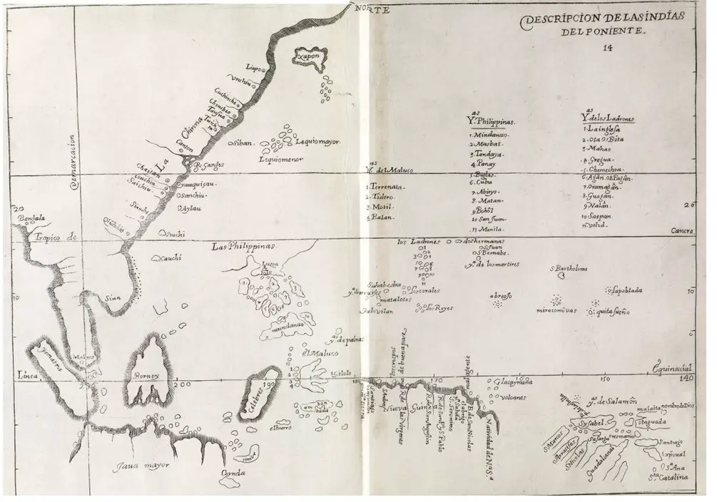
 The islands Grijalva discovered would not be the only ones to constitute Spain’s empire in the Pacific. To compete with the Portuguese, the Spanish soon acquired much more land in that part of the world. In 1542, just 5 years after Grijalva, the new viceroy in New Spain, the man who replaced Cortés named Antonio de Mendoza, sent an expedition to the Philippines. In 1565 the Spanish established a permanent colony there at a place called San Miguel. From this place, they established other settlements and trading posts, eventually conquering the Philippines. This was all being done from Mexico City. All new territories acquired in East Asia or the western Pacific were politically part of New Spain. The Spanish enlarged their presence in the area and eventually acquired chunks of the Indonesian islands of Borneo and Sulawesi and what is now Taiwan; and then claimed Guam, the Mariana Islands, Palau and the Caroline Islands which they called Las Nuevas Filipinas. It is important to note that the 4 small island groups discovered by Grijalva are not connected to any of these larger territories and are somewhat isolated and off to the side. They are not part of any island chain or archipelago.
When the Viceroyalty of New Spain collapsed with the independence of Mexico in 1822, Spain’s lands in the East were then ruled directly from Madrid and were reorganized into the Spanish East Indies. It is important to note here which territories were considered part of an independent Mexico and which ones weren’t. Those islands immediately off Mexico’s west coast were part of the new country of Mexico and so was anything else that was not considered to be the Spanish East Indies. There has been a case made that Alaska is really part of Mexico based on this definition of Mexico’s territorial boundaries. For more information on Mexico’s possible claims to Alaska, please see Mexico Unexplained episode number 137: https://www.youtube.com/watch?v=SsZ5lYg2LNA But back to Grijalva’s islands, we can get a sense of where they belonged when Spain decided to liquidate its territories in the area, many centuries after the Santiago sailed the waters of the South Seas under orders from Cortés.
After the Spanish-American War of 1898, Spain ceded the Philippines and Guam to the United States under the terms outlined in the Treaty of Paris. Spain still had possessions in the Pacific, though, that were not very economically viable because they had long been ignored by Madrid. With the Philippines and Guam in American hands, the Caroline Islands, Palau and the Marianas were seen as ungovernable, indefensible and non-productive. In 1899, Spain sold these island groups to Germany which placed them under the jurisdiction of imperial Germany’s colony of German New Guinea. The treaty specified precise lines of latitude and longitude of the remaining Spanish East Indies to be transferred to Germany, and Grijalva’s four islands fell outside of the delineations outlined in the treaty. So, if they were not part of the treaty, we have Spain tacitly recognizing that Grijalva’s islands were not part of the Spanish East Indies at all. If they were Spanish possessions that were not part of the Spanish East Indies, that must mean, some claim, that they must have been a part of the old New Spain viceregency and thus are now part of Mexico.
 The question of the sovereignty of the 4 islands came up in 1949 when a Spanish author named Emilio Pastor y Santos wrote a book titled Territories of Spanish Sovereignty in Oceania which got the attention of the Francisco Franco government in Madrid. The book claimed that the islands were still Spanish. At the time of the book’s publication, the United States had recently acquired the former Spanish Pacific islands from Japan which had taken over ruling them when Germany lost World War I. It was unclear post-World War II if Grijalva’s 4 islands were part of the newly organized American Trust Territory of the Pacific. The Spanish government looked into the question and considered taking the issue to the United Nations but didn’t. In 2014 the Spanish government closed the issue of Spain’s ownership of the islands, claiming that the spirit of the 1899 treaty with Germany was to cede all the Spanish Pacific islands to the German Empire and that even though the territorial boundaries were off, Spain had no interest in ruling an overseas possession in the 21st Century. But what about Mexico? Could these islands technically have always been part of Mexican territory? Currently, the island formerly known as Los Guedes belongs to Indonesia and the other three of Grijalva’s islands are part of the Federated States of Micronesia. While it may be an interesting idea to make these islands part of Mexico, it would take some political will in Mexico City and at least some desire from the islanders themselves. For now, this is just an interesting footnote of a forgotten and obscure history and most likely nothing will ever come of this.
REFERENCES
Pastor y Santos, Emilio. Territorios de Soberanía Española en Oceanía. Madrid: Instituto de Estudios Africanos, 1950.